Tameside Trail
A 32 mile walking trail around Tameside passing through all the nine towns, along the three river valleys and canals, through the country parks and many of the local nature reserves.
Over heather moorland and farmland, through formal parks and woodlands with constantly changing and far-flung views, together with a rich heritage, it combines to provide a walk full of interest and enjoyment.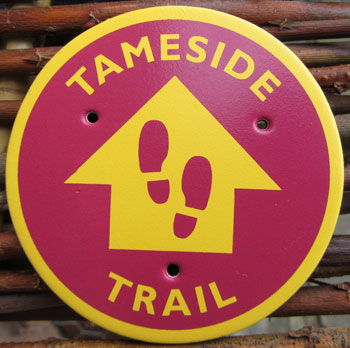
Split into eight sections of varying lengths, public transport is available at the start and finish of each section.
Click on each section and you will find downloadable maps and routes.
Bardsley Bridge to Manchester Road, MossleyManchester Road Mossley to Carrbrook
Carrbrook to Hollingworth
Hollingworth to Broadbottom
Broadbottom to Werneth Low
Werneth Low to Stockport Road, Denton
Stockport Road, Denton to Audenshaw
Audenshaw to Bardsley Bridge
Bardsley Bridge to Manchester Road, Mossley
Distance: 5.8 Miles (9.3km)
Ordnance Survey Maps: Landranger 109 Outdoor Leisure 277 and OL1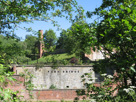
Start: Bardsley Bridge, Oldham Road, Ashton under Lyne. OL7 9PG
(Grid Reference SD930 014)
Finish: Manchester Road/Shadows Lane, Mossley. OL5 9BS
(Grid Reference SD 983 036)
Transport Links Start:
Bus 409, 396, 419
Tram Ashton under Lyne. 1.2 miles
Railway station Ashton under Lyne. 1.3 miles
Transport Links Finish:
Bus 343, 350, 354
Railway station Greenfield 1 mile
Railway station Mossley 1.2 miles
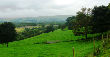
This section of the path, offers a great variety of walking. Through historic Park Bridge, over Hartshead Pike, a well know landmark and down to the Tame Valley. There are extensive views over Greater Manchester, Cheshire, Derbyshire, Lancashire and North Wales.
Downloads
Bardsley Bridge to Manchester Road, Mossley - route description
Bardsley Bridge to Manchester Road, Mossley - map
Manchester Road Mossley to Carrbrook
Distance: 2 Miles (3.2km)
Ordnance Survey Maps: Landranger 109 Outdoor Leisure OL1
Start: Royal George, Manchester Road, Greenfield. OL3 7HX
(Grid Reference SD 983 036)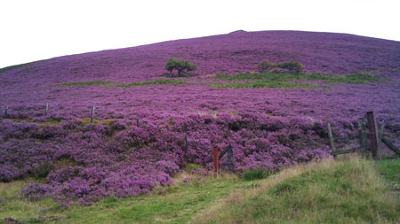
Finish: Castle Clough car park, Buckton Vale Road, Carrbrook, Stalybridge. SK15 3PG
(Grid Reference SD 988 011)
Transport Links Start:
Bus 343, 348
Railway station Greenfield 1 mile
Transport Links Finish:
Bus 343,
Railway station Mossley 1.3 miles
Starting from Manchester Road, there is a steep climb followed by an enjoyable walk on a walled track contouring the valley side. This section ends in Carrbrook, a former textile village.
Downloads
Manchester Road Mossley to Carrbrook - route description
Manchester Road Mossley to Carrbrook - map
Carrbrook to Hollingworth
Distance: 4.7 miles (7.5km)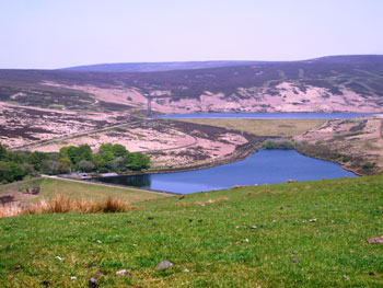
Ordnance Survey Maps: Landranger 109/110 Outdoor Leisure OL1
Start: Castle Clough car park, Buckton Vale Road, Carrbrook, Stalybridge. SK15 3PG
(Grid Reference SD 988 011)
Finish: Market Street, Hollingworth. SK14 8HR
(Grid Reference SK 007 963)
Transport Links Start:
Bus 343, 348
Railway station Mossley 1.3 miles
Transport Links Finish:
Bus 236, 237
Railway station Broadbottom 2.6 miles
A steady climb to the highest, wildest and most exposed part of the trail over open moorland before descending into Hollingworth village. Wonderful scenery and excellent paths throughout.
Downloads
Carrbrook to Hollingworth - route description
Carrbrook to Hollingworth - map
Hollingworth to Broadbottom
 Distance: 2.4 miles (3.8km)
Ordnance Survey Maps: Landranger 109/110 Outdoor Leisure OL1
Start: Market Street, Hollingworth. SK14 8HR
(Grid Reference SK 007 963)
Finish: Lymefield, off Lower Market Street, Broadbottom, SK14 6AG
(Grid Reference SJ 996 935)
Transport Links Start:
Bus 236, 237
Transport Links Finish:
Bus 341
Railway station Broadbottom 0.5 miles
A quiet lane leads to the River Etherow, beyond Woolley Bridge there is pleasant walking through fields.
Downloads
Hollingworth to Broadbottom - route description
Hollingworth to Broadbottom - maps
Section 5: Broadbottom to Werneth Low
Distance: 3.5 miles (5.6 km)
Ordnance Survey Maps: Landranger 109 Outdoor Leisure OL1 and 277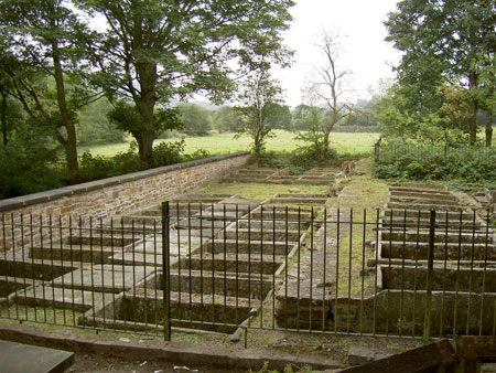
Start: Lymefield, off Lower Market Street, Broadbottom, SK14 6AG
(Grid Reference SJ 996 935)
Finish: Quarry Car Park, Werneth Low Road, Top of Joel Lane, Gee Cross, Hyde, SK14 5LW
(Grid Reference SJ 960 928)
Transport Links Start:
Bus 341
Railway station Broadbottom 0.5 mile
Transport Links Finish:
Bus 341
Railway station Hyde Central 2 miles
Woodley 1.8 miles
Through an area of historic interest, along the River Etherow, then steeply up through Back Wood and onto the slopes of Werneth Low with its extensive views.
Downloads
Broadbottom to Werneth Low, Hyde - route description
Broadbottom to Werneth Low, Hyde - map
Werneth Low to Stockport Road, Denton
Distance: 5 miles (8 km)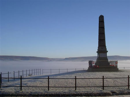
Ordnance Survey Maps: Landranger 109 Outdoor Leisure 277
Start: Quarry Car Park, Werneth Low Road, Top of Joel Lane, Gee Cross, Hyde, SK14 5LW
(Grid Reference SJ 960 928)
Finish: Stockport Road, Denton. M34 6ET
(Grid Reference SJ 922 937)
Transport Links Start:
Bus 341
Railway station Hyde Central 1.6 miles
Woodley 1.6 miles
Transport Links Finish:
Bus 322, 327
From the heights of Werneth Low with its extensive views over Greater Manchester, Lancashire, Cheshire, Derbyshire and North Wales, the path is downhill to the Peak Forest Canal and River Tame.
Downloads
Werneth Low, Hyde to Stockport Road, Denton - route description
Back to top
Stockport Road, Denton to Audenshaw
Distance: 4 miles (6.4 km)
Ordnance Survey Maps: Landranger 109 Outdoor Leisure 277
Start: Stockport Road, Denton. M34 6ET
(Grid Reference SJ 922 937)
Finish: Audenshaw Road, Audenshaw (Junction with King’s Road) M34 5PJ
(Grid Reference SJ 912 973)
Transport Links Start:
Bus 322, 327
Transport Links Finish:
Bus 219
Tram Audenshaw 0.7 miles
A mainly urban stretch of the trail with a formal park and reservoirs.
Downloads
Stockport Road, Denton to Audenshaw Road, Audenshaw - route description.
Stockport Road, Denton to Audenshaw Road, Audenshaw - map.
Audenshaw to Bardsley Bridge
Distance: 5 miles (8 km)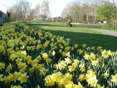
Ordnance Survey Maps: Landranger 109 Outdoor Leisure 277
Start: Audenshaw Road, Audenshaw (Junction with King’s Road) M34 5PJ
(Grid Reference SJ 912 973)
Finish: Bardsley Bridge, Oldham Road, Ashton under Lyne. OL7 9PG
(Grid Reference SD 930 014)
Transport Links Start:
Bus 219
Tram Audenshaw 0.7 miles
Transport Links Finish:
Bus 409, 396, 419
Tram Ashton under Lyne. 1.2 miles
Railway station Ashton under Lyne. 1.3 miles
After a short urban stretch, the trail follows the Hollinwood Branch Canal
Downloads
Audenshaw to Bardsley Bridge, Oldham Road, Ashton under Lyne - route description.
Section 8: Audenshaw to Bardsley Bridge, Oldham Road, Ashton under Lyne - map.
If you come across any problems, complete the whole trail, or just have any comments we would like to hear from you.
Please contact us on parkbridge@tameside.gov.uk